|
4/16/2022 0 Comments Developing the MapOver the last few weeks, I have been recording more trail data with my GPS unit. I just finished uploading some new segments (second map, in green) to see what I might have missed. I have almost every trail shown in the old map for the N-Wing/Delaware Interpretive trail. There are still some lines that need to be cleaned up, but I will wait to do that from a campus computer. Delaware Avenue has a main trail with many firebreaks extending from it, marked with flagging. I relied on my GPS to check which firebreaks I had already recorded and I was pretty sure that I covered every firebreak that looked clear. Compared to the Delaware Avenue Map in the Forest Management Plan, I don't have as many segments. I would like to revisit the Sustainability Farm and the west side of the Delaware Avenue trail, see if there is a trail around Lake Naomi, and fill in some of the gaps around the South Interpretive Trail. After some editing, trail measuring, and labeling, the map should be finished. Uploading data to ArcMap: I convert the data to a .CSV, edit the columns as needed, and add the data to ArcMap. The data needs to be converted again to XY data, which gives me a layer with points. The points are then converted to lines. Additional corrections needed: edit scale bar, add names and descriptions, measure trail distances 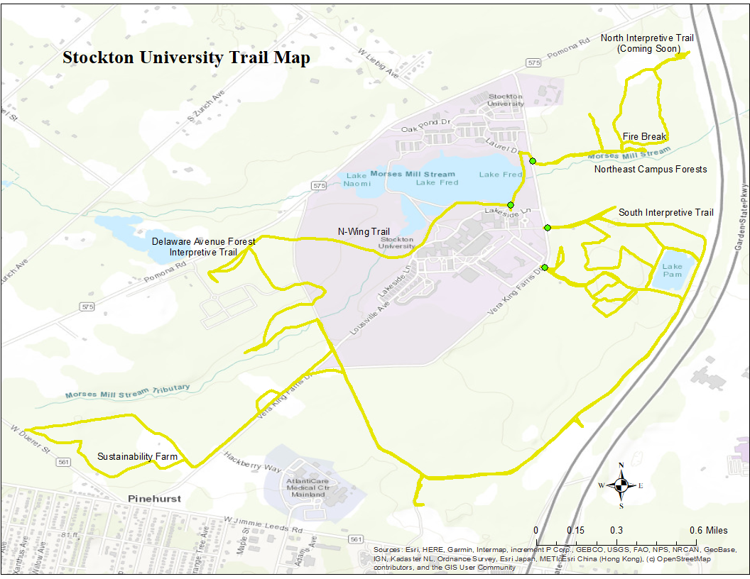 Map as of March 2022 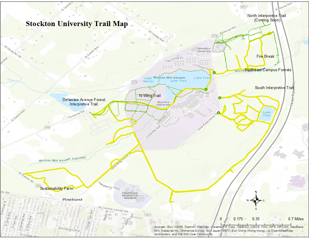 Map as of April 16th 2022
0 Comments
Leave a Reply. |
AuthorWrite something about yourself. No need to be fancy, just an overview. ArchivesCategories |
 RSS Feed
